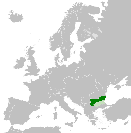
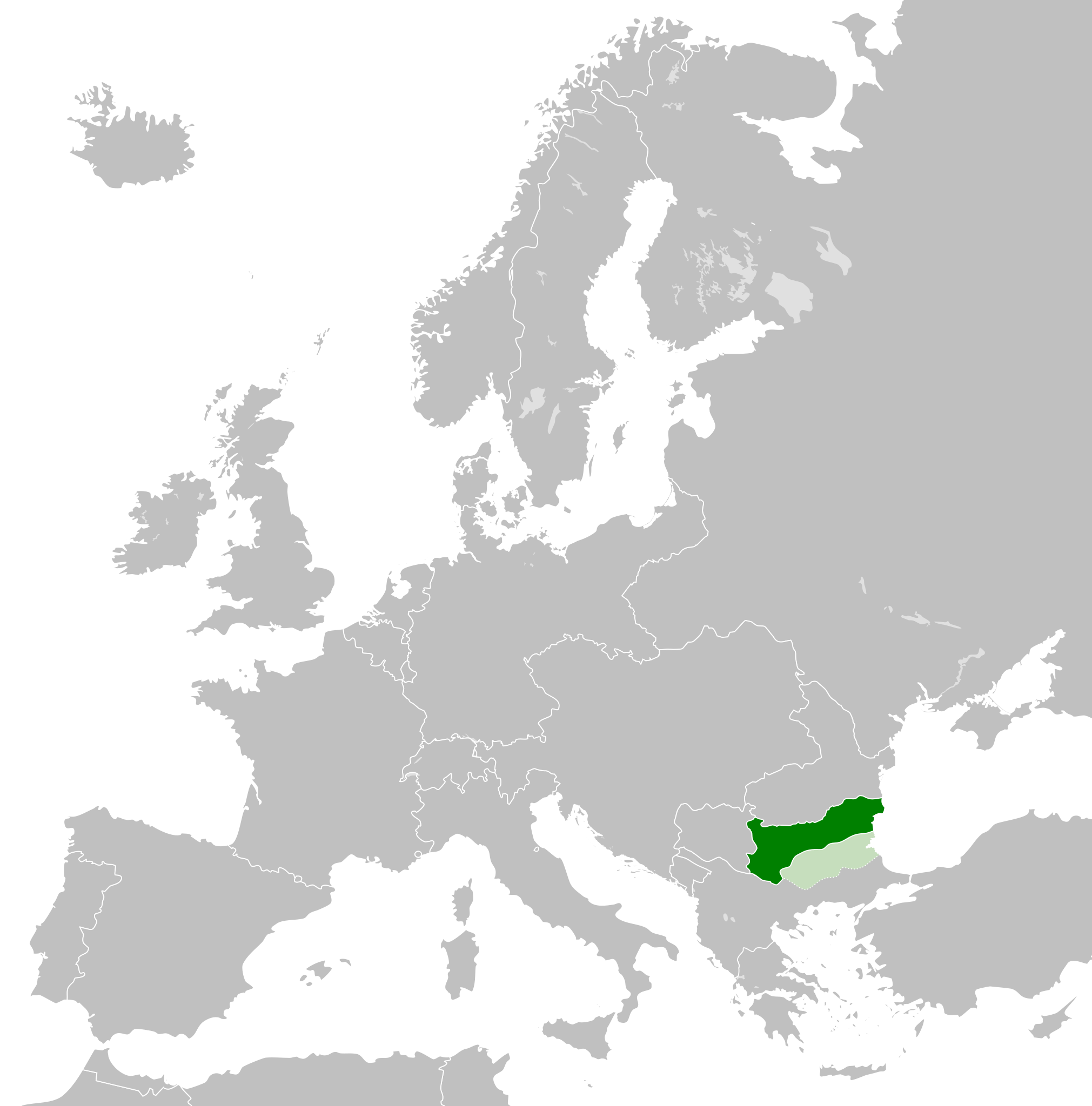
Ficheiro:Principality of Bulgaria (1890).svg

Dimensões desta antevisão em PNG do ficheiro SVG: 450 × 456 píxeis Outras resoluções: 237 × 240 píxeis | 474 × 480 píxeis | 758 × 768 píxeis | 1 011 × 1 024 píxeis | 2 021 × 2 048 píxeis.
Imagem numa resolução maior (ficheiro SVG, de 450 × 456 píxeis, tamanho: 437 kB)
|
|
Esta imagem provém do Wikimedia Commons, um acervo de conteúdo livre da Wikimedia Foundation que pode ser utilizado por outros projetos.
|


.svg)
.svg)
.svg)
.svg)
.svg)


.svg)
.svg)
.svg)


.png)
.png)


.svg)


.svg)

.svg)


.svg)
.svg)
.svg)
.svg)


.svg)
.png)


.svg)


.svg)
.svg)


.svg)


.svg)


.svg)
.svg)
.svg)
.svg)
.svg)
.svg)
.svg)
.svg)
_cropped.svg)
.svg)
.svg)
.svg)
.svg)
.svg)
.svg)
.svg)
.svg)
.svg)
.svg)
.svg)
.svg)
.svg)
.svg)
.svg)
.svg)
.svg)
.svg)
.svg)
.svg)
.svg)
.svg)
.svg)
.svg)
.svg)
.svg)
.svg)
.svg)
.svg)
.svg)
.svg)
.svg)
.svg)
.svg)
.svg)
.svg)
.svg)
.svg)
.svg)
.svg)
.svg)
.svg)
.svg)
.svg)
Histórico do ficheiro
Clique uma data e hora para ver o ficheiro tal como ele se encontrava nessa altura.
| Data e hora | Miniatura | Dimensões | Utilizador | Comentário | |
|---|---|---|---|---|---|
| atual | 17h37min de 25 de julho de 2013 | | 450 × 456 (437 kB) | Alphathon | Removed Dutch polders (weren't completed until the mid 20th century) |
| 17h16min de 21 de julho de 2013 |  | 450 × 456 (423 kB) | TRAJAN 117 | Adjustment | |
| 18h11min de 12 de março de 2012 |  | 450 × 456 (423 kB) | TRAJAN 117 | {{Information |Description ={{en|1=The Principality of Bulgaria, with Eastern Rumelia in 1890.}} |Source ={{own}} {{AttribSVG|Blank map of Europe 1890.svg|Alphathon}} |Author =25px '''[[User... |
Utilização local do ficheiro
A seguinte página usa este ficheiro:
Utilização global do ficheiro
As seguintes wikis usam este ficheiro:
- ar.wikipedia.org
- ast.wikipedia.org
- az.wikipedia.org
- bg.wikipedia.org
- ca.wikipedia.org
- cs.wikipedia.org
- da.wikipedia.org
- de.wikipedia.org
- el.wikipedia.org
- en.wikipedia.org
- es.wikipedia.org
- et.wikipedia.org
- eu.wikipedia.org
- fi.wikipedia.org
- he.wikipedia.org
- hy.wikipedia.org
- id.wikipedia.org
- it.wikipedia.org
- ja.wikipedia.org
- ka.wikipedia.org
- ko.wikipedia.org
- lt.wikipedia.org
- lv.wikipedia.org
- mk.wikipedia.org
- ms.wikipedia.org
- mt.wikipedia.org
- ru.wikipedia.org
- sl.wikipedia.org
- sq.wikipedia.org
- sr.wikipedia.org
- uk.wikipedia.org
- vi.wikipedia.org
Ver mais utilizações globais deste ficheiro.
.svg)
.svg)