Ficheiro:American attack on Quebec.svg

Imagem numa resolução maior (ficheiro SVG, de 883 × 1 077 píxeis, tamanho: 752 kB)
|
|
Esta imagem provém do Wikimedia Commons, um acervo de conteúdo livre da Wikimedia Foundation que pode ser utilizado por outros projetos.
|
Descrição do ficheiro
| Descrição |
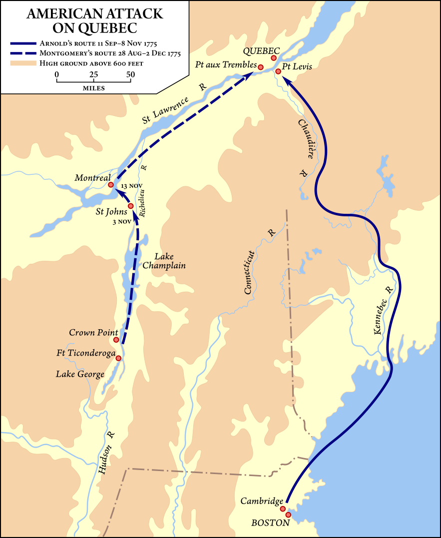
Map showing the routes taken by the Benedict Arnold and Richard Montgomery expeditions into Quebec as part of the American Invasion of Canada (1775). O código-fonte desta imagem SVG é válido. Esta imagem vectorial foi criada com Inkscape, e depois editada manualmente . |
| Data | Vectorized September 19–20, 2008 |
| Origem | Vector version of Image:American quebec 1775.jpg, from American Military History, United States Army Center of Military History, 1989, courtesy of the University of Texas Libraries, The University of Texas at Austin. |
| Autor | United States Army Center of Military History, vector version by Fvasconcellos (discussão · contribs) |
| Permissão (Reutilizar este ficheiro) |
This image is derived from a work of the U.S. government and, as such, is in the public domain. |
| Outras versões | Image:American quebec 1775.jpg |
Licenciamento
| This image is in the public domain because it contains materials that originally came from the United States Army Center of Military History, subject to the following qualification.
Note: The images of all badges, insignia, decorations and medals on the "CMH Online" web site are produced by the United States Army Institute of Heraldry and protected by Title 18, United States Code, Section 704 and the Code of Federal Regulations (32 CFR, Part 507). Permission to use these images for commercial purposes must be obtained from The Institute of Heraldry prior to their use. |

|
Histórico do ficheiro
Clique uma data e hora para ver o ficheiro tal como ele se encontrava nessa altura.
| Data e hora | Miniatura | Dimensões | Utilizador | Comentário | |
|---|---|---|---|---|---|
| atual | 01h54min de 21 de setembro de 2008 | | 883 × 1 077 (752 kB) | Fvasconcellos | ==Summary== {{validSVG}} {{Information |Description=Map showing the routes taken by the {{w|Benedict Arnold}} and {{w|Richard Montgomery}} expeditions into Quebec as part of the American {{w|Invasion of Canada (1775)}}.<br/> Vector version of [[:Image:Ame |
Utilização local do ficheiro
A seguinte página usa este ficheiro:
Utilização global do ficheiro
As seguintes wikis usam este ficheiro:
- ca.wikipedia.org
- da.wikipedia.org
- de.wikipedia.org
- en.wikipedia.org
- es.wikipedia.org
- fr.wikipedia.org
- he.wikipedia.org
- id.wikipedia.org
- it.wikipedia.org
- ja.wikipedia.org
- ko.wikipedia.org
- ms.wikipedia.org
- ro.wikipedia.org
- ru.wikipedia.org
- sh.wikipedia.org
- uk.wikipedia.org
- www.wikidata.org
- zh.wikipedia.org