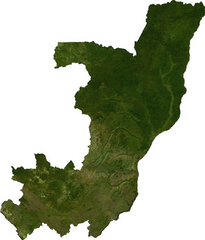
Ficheiro:Congo sat.png

Dimensões desta antevisão: 512 × 600 píxeis. Outras resoluções: 205 × 240 píxeis | 410 × 480 píxeis | 894 × 1 047 píxeis.
Imagem numa resolução maior (894 × 1 047 píxeis, tamanho: 778 kB, tipo MIME: image/png)
|
|
Esta imagem provém do Wikimedia Commons, um acervo de conteúdo livre da Wikimedia Foundation que pode ser utilizado por outros projetos.
|
ECW to TIFF to PNG (compression level 9).
| This file is in the public domain, because it was generated by a user, using free sources available at The Map Library.
Note that this does not include the maps in the Global Administrative Areas section of the homepage. |
Histórico do ficheiro
Clique uma data e hora para ver o ficheiro tal como ele se encontrava nessa altura.
| Data e hora | Miniatura | Dimensões | Utilizador | Comentário | |
|---|---|---|---|---|---|
| atual | 04h11min de 13 de julho de 2006 | | 894 × 1 047 (778 kB) | Unquietwiki | ECW to TIFF to PNG (compression level 9). {{PD-MapLibrary}} |
Utilização local do ficheiro
A seguinte página usa este ficheiro:
Utilização global do ficheiro
As seguintes wikis usam este ficheiro:
- af.wikipedia.org
- ast.wikipedia.org
- en.wikipedia.org
- es.wikipedia.org
- ka.wikipedia.org
- lt.wikipedia.org
- mt.wikipedia.org
- pl.wikipedia.org
- uk.wikipedia.org