Ficheiro:Map of Hawaii NA.png
Dimensões desta antevisão: 776 × 600 píxeis. Outras resoluções: 311 × 240 píxeis | 621 × 480 píxeis | 994 × 768 píxeis | 1 280 × 989 píxeis | 2 122 × 1 640 píxeis.
Imagem numa resolução maior (2 122 × 1 640 píxeis, tamanho: 370 kB, tipo MIME: image/png)
|
|
Esta imagem provém do Wikimedia Commons, um acervo de conteúdo livre da Wikimedia Foundation que pode ser utilizado por outros projetos.
|
Descrição do ficheiro
| Descrição |
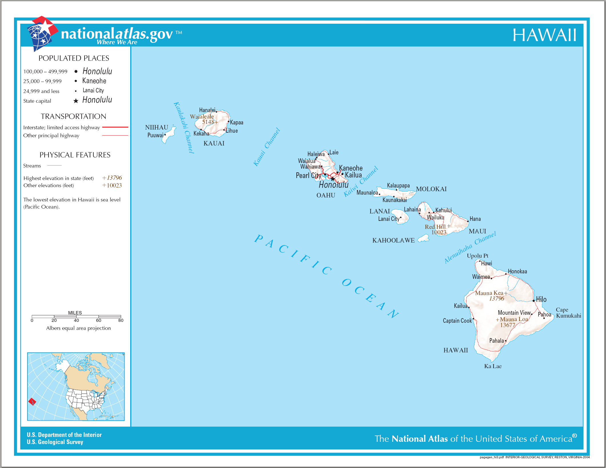
English: Reference Map of Hawaii. |
| Data | |
| Origem | |
| Autor | National Atlas of the United States |
| Permissão (Reutilizar este ficheiro) |
Public domain |
Licenciamento
This map was obtained from an edition of the National Atlas of the United States. Like almost all works of the U.S. federal government, works from the National Atlas are in the public domain in the United States.
Online access: NationalAtlas.gov | 1970 print edition: Library of Congress, Perry-Castañeda Library
|
Histórico do ficheiro
Clique uma data e hora para ver o ficheiro tal como ele se encontrava nessa altura.
| Data e hora | Miniatura | Dimensões | Utilizador | Comentário | |
|---|---|---|---|---|---|
| atual | 10h26min de 15 de agosto de 2006 | | 2 122 × 1 640 (370 kB) | Huebi~commonswiki | {{Information| |Description=Map of Hawaii |Source=[http://www.nationalatlas.gov National Atlas] }} Category:Maps of the United States Category:Maps of Hawaii {{PD-USGov-Atlas}} |
Utilização local do ficheiro
A seguinte página usa este ficheiro:
Utilização global do ficheiro
As seguintes wikis usam este ficheiro:
- af.wikipedia.org
- als.wikipedia.org
- cs.wikipedia.org
- da.wikipedia.org
- de.wikipedia.org
- en.wikipedia.org
- es.wikipedia.org
- fa.wikipedia.org
- he.wikipedia.org
- hr.wikipedia.org
- hr.wiktionary.org
- hsb.wikipedia.org
- hu.wikipedia.org
- incubator.wikimedia.org
- it.wikipedia.org
- kn.wikipedia.org
- ko.wikipedia.org
- mk.wikipedia.org
- ml.wikipedia.org
- nl.wikipedia.org
- pam.wikipedia.org
- pdc.wikipedia.org
- pl.wikipedia.org
- ru.wikivoyage.org
- sh.wikipedia.org
- sr.wikipedia.org
- sv.wikipedia.org
- sw.wikipedia.org
- te.wikipedia.org
- zea.wikipedia.org