Ficheiro:Surrey UK locator map 2010.svg

Dimensões desta antevisão em PNG do ficheiro SVG: 494 × 600 píxeis Outras resoluções: 198 × 240 píxeis | 395 × 480 píxeis | 633 × 768 píxeis | 843 × 1 024 píxeis | 1 687 × 2 048 píxeis | 1 108 × 1 345 píxeis.
Imagem numa resolução maior (ficheiro SVG, de 1 108 × 1 345 píxeis, tamanho: 302 kB)
|
|
Esta imagem provém do Wikimedia Commons, um acervo de conteúdo livre da Wikimedia Foundation que pode ser utilizado por outros projetos.
|
Descrição do ficheiro
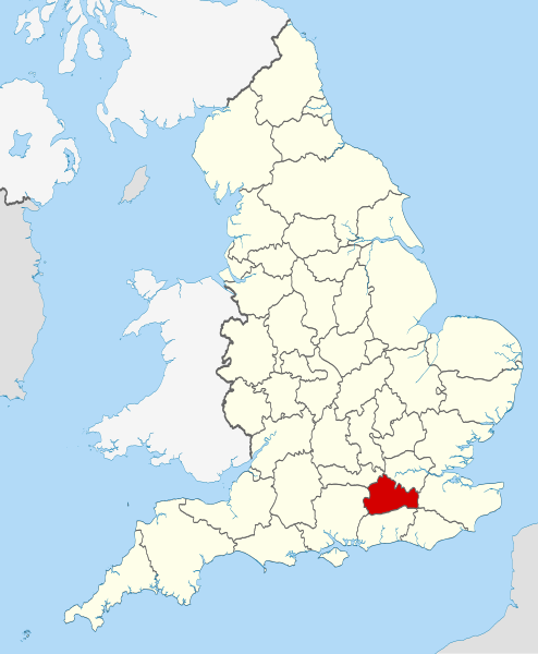
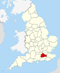
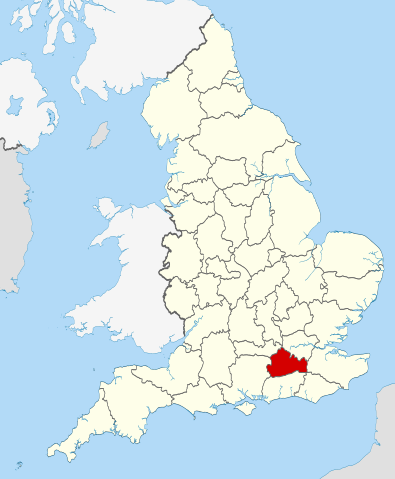
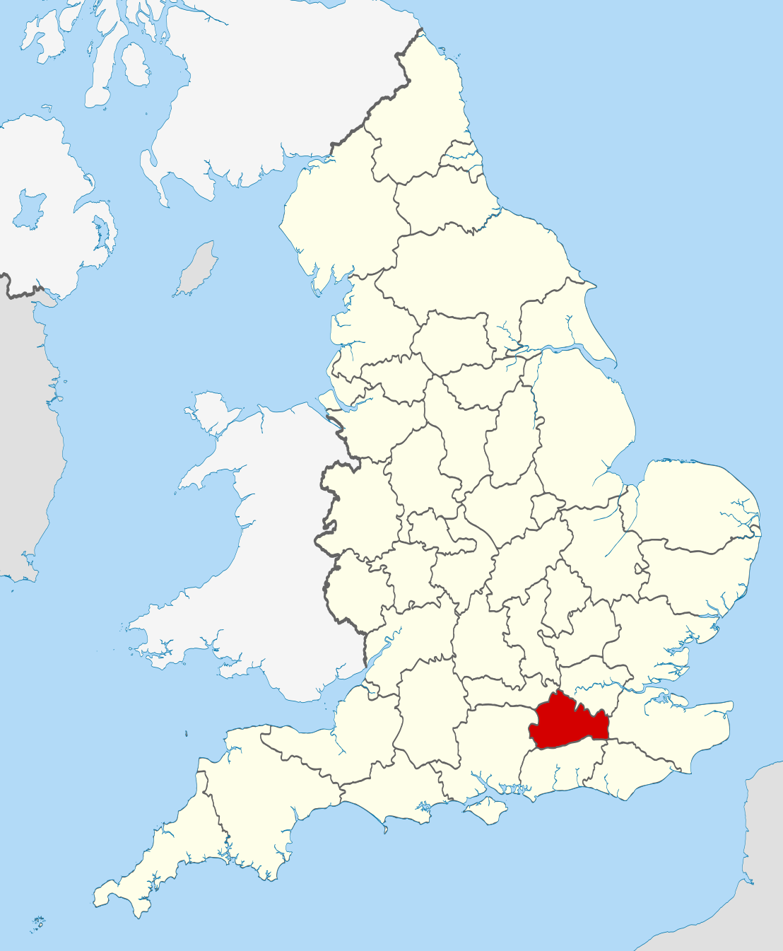
| Descrição | Location of the ceremonial county of Surrey within England. |
| Data | |
| Origem |
National Geospatial-Intelligence Agency
|
| Autor | Nilfanion |
Licenciamento
Eu, titular dos direitos de autor desta obra, publico-a com as seguintes licenças:
A utilização deste ficheiro é regulada nos termos da licença Creative Commons - Atribuição-CompartilhaIgual 3.0 Não Adaptada.
- Pode:
- partilhar – copiar, distribuir e transmitir a obra
- recombinar – criar obras derivadas
- De acordo com as seguintes condições:
- atribuição – Tem de fazer a devida atribuição da autoria, fornecer uma hiperligação para a licença e indicar se foram feitas alterações. Pode fazê-lo de qualquer forma razoável, mas não de forma a sugerir que o licenciador o apoia ou subscreve o seu uso da obra.
- partilha nos termos da mesma licença – Se remisturar, transformar ou ampliar o conteúdo, tem de distribuir as suas contribuições com a mesma licença ou uma licença compatível com a original.

|
É concedida permissão para copiar, distribuir e/ou modificar este documento nos termos da Licença de Documentação Livre GNU, versão 1.2 ou qualquer versão posterior publicada pela Free Software Foundation; sem Secções Invariantes, sem textos de Capa e sem textos de Contra-Capa. É incluída uma cópia da licença na secção intitulada GNU Free Documentation License. |
Pode escolher a licença que quiser.

|
Esta é uma das imagens que fazem parte do conjunto de Imagens de valor: Locator maps of the Ceremonial counties of England no Wikimedia Commons. O conjunto de imagens foi avaliado sob os Critérios de conjuntos de Imagens de valor e é considerado o conjunto mais valorizado no Commons dentro do escopo:
Locator maps of the Ceremonial counties of England
Você pode ver a sua nomeação em Commons:Valued image candidates/Locator maps of English ceremonial counties. |
Histórico do ficheiro
Clique uma data e hora para ver o ficheiro tal como ele se encontrava nessa altura.
| Data e hora | Miniatura | Dimensões | Utilizador | Comentário | |
|---|---|---|---|---|---|
| atual | 22h45min de 23 de novembro de 2010 | | 1 108 × 1 345 (302 kB) | Nilfanion | == Summary == {{Information |Description=Location of the ceremonial county of Surrey within England. |Source=Ordnance Survey [https://www.ordnancesurvey.co.uk/opendatadownload/products.html OpenData]: *County boundaries |
Utilização local do ficheiro
A seguinte página usa este ficheiro:
Utilização global do ficheiro
As seguintes wikis usam este ficheiro:
- af.wikipedia.org
- ar.wikipedia.org
- arz.wikipedia.org
- ast.wikipedia.org
- azb.wikipedia.org
- az.wikipedia.org
- be-tarask.wikipedia.org
- be.wikipedia.org
- bg.wikipedia.org
- ca.wikipedia.org
- ceb.wikipedia.org
- cs.wikipedia.org
- el.wikipedia.org
- en.wikipedia.org
- Surrey
- Winkworth Arboretum
- Witley Common
- Farley Green, Surrey
- Ribsden Holt
- Template:Surrey-geo-stub
- Winterfold Forest
- The Rye (brook)
- Savill Garden
- Wey South Path
- Ramster
- Blackheath Common
- Sandhills, Surrey
- Molesey Reservoirs
- Knight Reservoir
- Sunnyside Reservoir
- Salfords and Sidlow
- Woolmer Hill
- Frimley Lodge Park
- Grade I listed buildings in Surrey
- Coldharbour, Surrey
- Mogador, Surrey
- Haste Hill
- Penton Hook Marina
- Mole Gap Trail
- Rushmoor, Surrey
- Grade II* listed buildings in Surrey
- 1977 Surrey County Council election
- Template:Infobox English county/testcases
- Truss's Island
- Chitty's Common
- Milton Heath and The Nower
- eo.wikipedia.org
- es.wikipedia.org
Ver mais utilizações globais deste ficheiro.