Ficheiro:BorahPeakID.jpg
Dimensões desta antevisão: 800 × 441 píxeis. Outras resoluções: 320 × 176 píxeis | 640 × 353 píxeis.
Imagem numa resolução maior (1 089 × 600 píxeis, tamanho: 125 kB, tipo MIME: image/jpeg)
|
|
Esta imagem provém do Wikimedia Commons, um acervo de conteúdo livre da Wikimedia Foundation que pode ser utilizado por outros projetos.
|
Descrição do ficheiro
| Descrição |
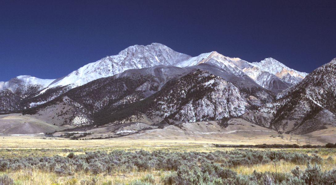
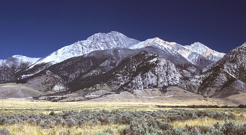
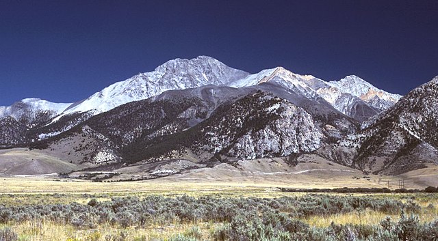
English: Borah Peak, Idaho, looking east. The normal climbing route begins in the wooded canyon at center left. The white line running along the base of the peak is the fault trace from the 1983 earthquake. |
| Data | 6 de maio de 2006 (data de carregamento original) |
| Origem | Transferido de en.wikipedia para a wiki Commons por RedWolf utilizando CommonsHelper. |
| Autor | G. Thomas em Wikipédia em inglês |
Licenciamento
| Esta obra foi dedicada ao domínio público pelo autor, G. Thomas em Wikipédia em inglês, com aplicação em todo o mundo. Nalguns países isto pode não ser legalmente possível; se assim for: G. Thomas concede a todos o direito de usar esta obra para qualquer fim, sem quaisquer condições, a menos que tais condições sejam impostas por lei. |
Registo de carregamento original
A página de descrição original está aqui. Todos os nomes de utilizador a seguir referem-se a en.wikipedia.
- 2006-05-06 20:17 G. Thomas 1089×600× (127941 bytes) Borah Peak, Idaho, looking east. The normal climbing route begins in the wooded canyon at center left. The white line running along the base of the peak is the fault trace from the 1983 earthquake.
Histórico do ficheiro
Clique uma data e hora para ver o ficheiro tal como ele se encontrava nessa altura.
| Data e hora | Miniatura | Dimensões | Utilizador | Comentário | |
|---|---|---|---|---|---|
| atual | 16h15min de 21 de fevereiro de 2009 | | 1 089 × 600 (125 kB) | RedWolf | {{Information |Description={{en|Borah Peak, Idaho, looking east. The normal climbing route begins in the wooded canyon at center left. The white line running along the base of the peak is the fault trace from the 1983 earthquake.}} |Source=Transferred f |
Utilização local do ficheiro
As seguintes 2 páginas usam este ficheiro:
Utilização global do ficheiro
As seguintes wikis usam este ficheiro:
- bg.wikipedia.org
- cs.wikipedia.org
- en.wikipedia.org
- List of mountains of the United States
- Borah Peak
- List of U.S. states and territories by elevation
- Lost River Range
- List of the most isolated major summits of the United States
- List of ultras of North America
- List of the most prominent summits of the United States
- List of the major 100-kilometer summits of North America
- Mountain states
- List of the highest major summits of North America
- List of the major 3000-meter summits of the Rocky Mountains
- List of the highest major summits of the United States
- es.wikipedia.org
- it.wikipedia.org
- it.wikivoyage.org
- nl.wikipedia.org
- ru.wikipedia.org
- simple.wikipedia.org
- uk.wikipedia.org