Ficheiro:C69198s1 Suvorov Glacier.jpg
Dimensões desta antevisão: 687 × 599 píxeis. Outras resoluções: 275 × 240 píxeis | 550 × 480 píxeis | 880 × 768 píxeis | 1 174 × 1 024 píxeis | 2 347 × 2 048 píxeis | 3 758 × 3 279 píxeis.
Imagem numa resolução maior (3 758 × 3 279 píxeis, tamanho: 1,4 MB, tipo MIME: image/jpeg)
|
|
Esta imagem provém do Wikimedia Commons, um acervo de conteúdo livre da Wikimedia Foundation que pode ser utilizado por outros projetos.
|
Descrição do ficheiro
| Descrição |
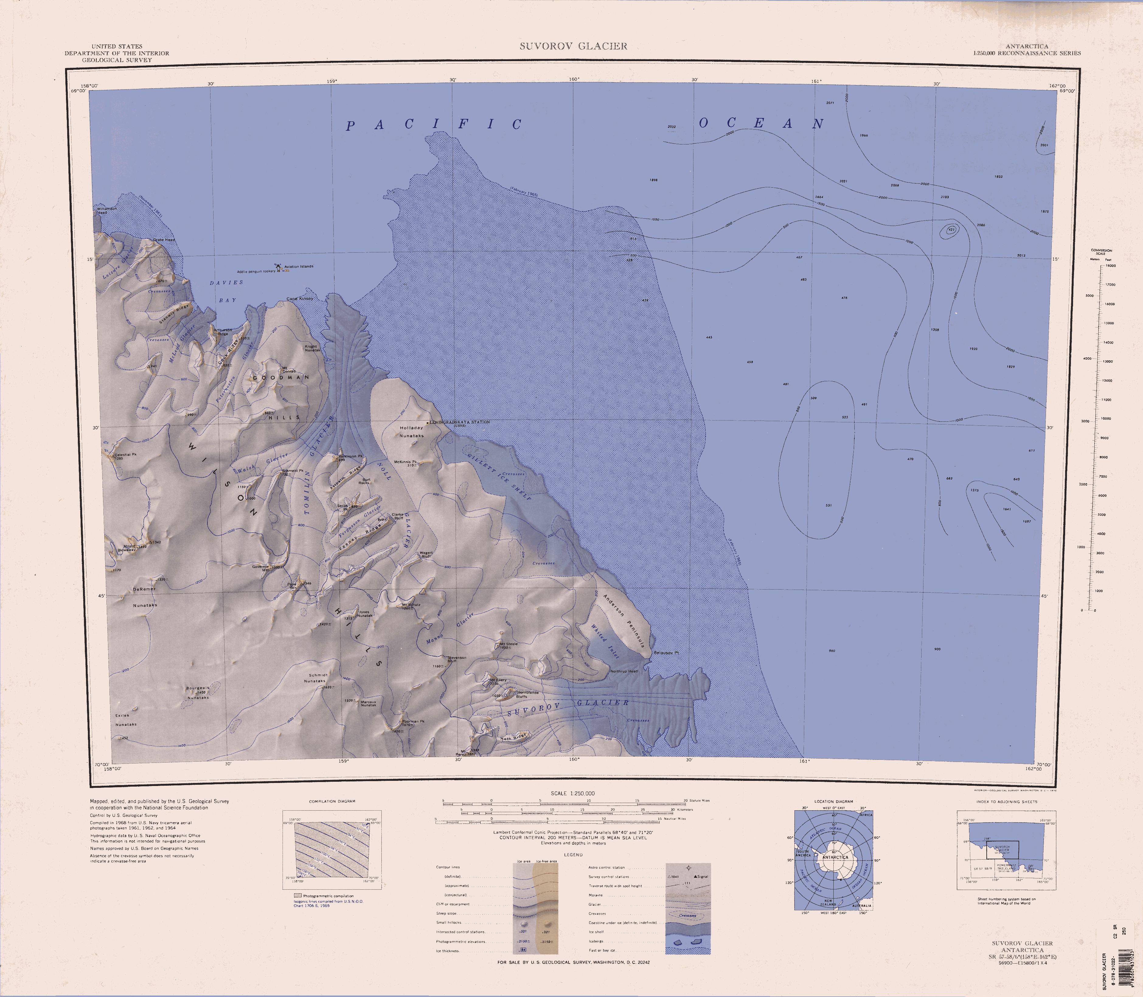
English: 1:250,000-scale topographic reconnaissance map of the Suvorov Glacier area from 158°-162°E to 69°-70°S in Antarctica. Mapped, edited and published by the U.S. Geological Survey in cooperation with the National Science Foundation. |
|||
| Data | ||||
| Origem | http://usarc.usgs.gov/drg_dload.shtml | |||
| Autor | United States Geological Survey | |||
| Permissão (Reutilizar este ficheiro) |
|
Histórico do ficheiro
Clique uma data e hora para ver o ficheiro tal como ele se encontrava nessa altura.
| Data e hora | Miniatura | Dimensões | Utilizador | Comentário | |
|---|---|---|---|---|---|
| atual | 09h24min de 15 de abril de 2005 | | 3 758 × 3 279 (1,4 MB) | Achim Raschka | Map of Antarctica by the United States Antarctic Ressource Center of the US Geological Society. {{PD-US}} Copyrights and Trademarks USGS-authored or produced data and information are in the public domain. While the content of most USGS web pages is in th |
Utilização local do ficheiro
As seguintes 2 páginas usam este ficheiro:
Utilização global do ficheiro
As seguintes wikis usam este ficheiro:
- bg.wikipedia.org
- ceb.wikipedia.org
- de.wikipedia.org
- Wilson Hills
- Belousov Point
- Suworow-Gletscher
- Gillett-Schelfeis
- Northrup Head
- Holladay-Nunatakker
- Tomilin-Gletscher
- Goodman Hills
- Governor Mountain
- Paternostro-Gletscher
- Davies Bay
- Cook Ridge
- Drake Head
- Oatesland
- Williamson Head
- Arthurson Ridge
- McLeod-Gletscher (Viktorialand)
- Stanwix Ridge
- Axthelm Ridge
- Parkinson Peak
- Jones-Nunatak
- Mount Perez
- Hornblende Bluffs
- Mount Ellery
- Mount Blowaway
- Bourgeois-Nunatakker
- Burt Rocks
- Celestial Peak
- Feeney Ridge
- Fergusson-Gletscher
- Serba Peak
- Mount Conrad
- DeRemer-Nunatakker
- Exiles-Nunatakker
- Heth Ridge
- Laizure-Gletscher
- Manna-Gletscher
- Marcoux-Nunatak
- Poorman Peak
- Schmidt-Nunatakker
- McKinnis Peak
- Walsh-Gletscher (Antarktika)
- Mount Steele (Antarktika)
- Whited Inlet
Ver mais utilizações globais deste ficheiro.