Ficheiro:Clingman's Dome Tower on a Sunny, Snowy Day.JPG

Dimensões desta antevisão: 800 × 600 píxeis. Outras resoluções: 320 × 240 píxeis | 640 × 480 píxeis | 1 024 × 768 píxeis | 1 280 × 960 píxeis | 2 592 × 1 944 píxeis.
Imagem numa resolução maior (2 592 × 1 944 píxeis, tamanho: 959 kB, tipo MIME: image/jpeg)
|
|
Esta imagem provém do Wikimedia Commons, um acervo de conteúdo livre da Wikimedia Foundation que pode ser utilizado por outros projetos.
|
|
Esta é uma imagem de um sítio ou edifício atualmente classificado no Registo Nacional de Lugares Históricos dos Estados Unidos da América. O seu número de referência é 12000515. |
Descrição do ficheiro
| Descrição |
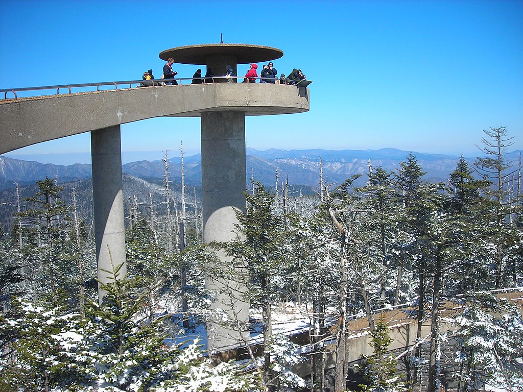
English: The Clingman's Dome Observation Tower rises 50 feet (15 m) from the summit of Clingman's Dome, the highest point both in the state of Tennessee and along the Appalachian Trail, in Great Smoky Mountains National Park. |
| Data | |
| Origem | Obra do próprio |
| Autor | Scott Basford |
| Localização do objecto | | Esta e outras imagens nas suas localizações em: OpenStreetMap |
|---|
Licenciamento
| Esta obra foi dedicada ao domínio público pelo autor, I, Blinutne, com aplicação em todo o mundo. Nalguns países isto pode não ser legalmente possível; se assim for: I, Blinutne concede a todos o direito de usar esta obra para qualquer fim, sem quaisquer condições, a menos que tais condições sejam impostas por lei. |
Histórico do ficheiro
Clique uma data e hora para ver o ficheiro tal como ele se encontrava nessa altura.
| Data e hora | Miniatura | Dimensões | Utilizador | Comentário | |
|---|---|---|---|---|---|
| atual | 23h37min de 23 de julho de 2007 | | 2 592 × 1 944 (959 kB) | Blinutne | {{Information |Description= The Clingman's Dome Observation Tower rises fifty feet from the pinnacle of Clingman's Dome, the highest point both in the state of Tennessee and along the Appalachian Trail, in the Great Smoky Mountains National Park. |Source= |
Utilização local do ficheiro
A seguinte página usa este ficheiro:
Utilização global do ficheiro
As seguintes wikis usam este ficheiro:
- ar.wikipedia.org
- ca.wikipedia.org
- da.wikipedia.org
- de.wikipedia.org
- en.wikipedia.org
- Great Smoky Mountains National Park
- Clingmans Dome
- Mountains-to-Sea Trail
- Mission 66
- National Register of Historic Places listings in Sevier County, Tennessee
- National Register of Historic Places listings in Swain County, North Carolina
- National Register of Historic Places listings in Great Smoky Mountains National Park
- List of federal lands in Tennessee
- Protected areas of North Carolina
- fr.wikipedia.org
- he.wikipedia.org
- he.wikivoyage.org
- hy.wikipedia.org
- it.wikipedia.org
- ja.wikipedia.org
- kk.wikipedia.org
- la.wikipedia.org
- nl.wikipedia.org
- no.wikipedia.org
- pl.wikipedia.org
- ru.wikipedia.org
- tr.wikipedia.org
- uk.wikipedia.org
- ur.wikipedia.org