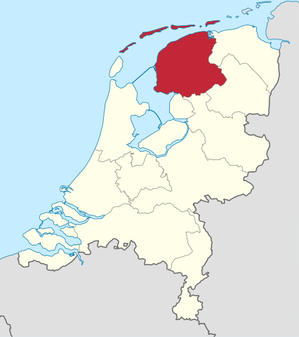
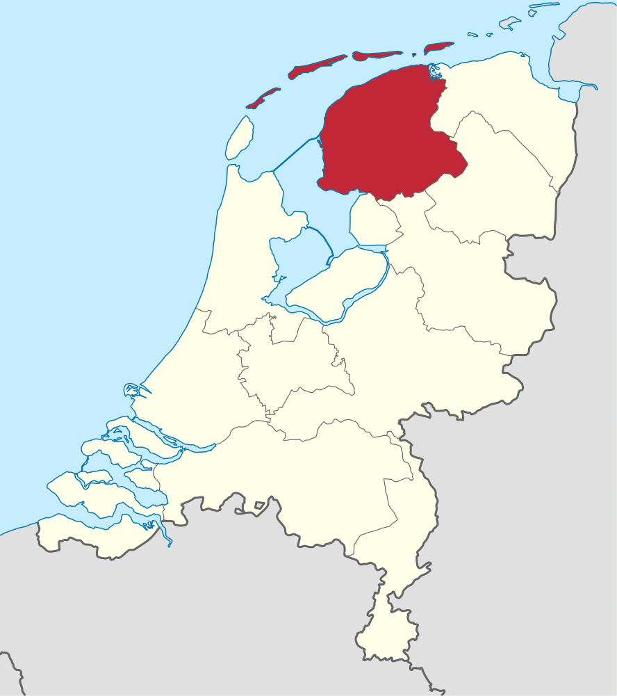
Ficheiro:Friesland in the Netherlands.svg

Dimensões desta antevisão em PNG do ficheiro SVG: 532 × 600 píxeis Outras resoluções: 213 × 240 píxeis | 426 × 480 píxeis | 681 × 768 píxeis | 908 × 1 024 píxeis | 1 817 × 2 048 píxeis | 888 × 1 001 píxeis.
Imagem numa resolução maior (ficheiro SVG, de 888 × 1 001 píxeis, tamanho: 147 kB)
|
|
Esta imagem provém do Wikimedia Commons, um acervo de conteúdo livre da Wikimedia Foundation que pode ser utilizado por outros projetos.
|
Descrição do ficheiro
.svg)
.svg)
.svg)
.svg)
.svg)
.svg)
.svg)

-en.svg)

.svg)
.svg)
.svg)

_(US48).svg)
_(small_islands_magnified)_(-mini_map_-rivers).svg)
.svg)
_(extra_close)_(US48).svg)
.svg)
_(zoom).svg)

.svg)


_(UNMIK).svg)
.svg)
_(disputed_hatched).svg)
_(claimed_and_disputed_hatched).svg)
.svg)
.svg)
_(%2Ball_claims_hatched).svg)

.svg)
_(shade).svg)
_(shade)_(special_marker).svg)
_(-mini_map).svg)
_(-mini_map).svg)
_(-mini_map).svg)


.svg)

.svg)
Licenciamento
Eu, titular dos direitos de autor desta obra, publico-a com as seguintes licenças:

|
É concedida permissão para copiar, distribuir e/ou modificar este documento nos termos da Licença de Documentação Livre GNU, versão 1.2 ou qualquer versão posterior publicada pela Free Software Foundation; sem Secções Invariantes, sem textos de Capa e sem textos de Contra-Capa. É incluída uma cópia da licença na secção intitulada GNU Free Documentation License. |
A utilização deste ficheiro é regulada nos termos da licença Creative Commons - Atribuição-CompartilhaIgual 3.0 Não Adaptada.
- Pode:
- partilhar – copiar, distribuir e transmitir a obra
- recombinar – criar obras derivadas
- De acordo com as seguintes condições:
- atribuição – Tem de fazer a devida atribuição da autoria, fornecer uma hiperligação para a licença e indicar se foram feitas alterações. Pode fazê-lo de qualquer forma razoável, mas não de forma a sugerir que o licenciador o apoia ou subscreve o seu uso da obra.
- partilha nos termos da mesma licença – Se remisturar, transformar ou ampliar o conteúdo, tem de distribuir as suas contribuições com a mesma licença ou uma licença compatível com a original.
Pode escolher a licença que quiser.

|
Eu apreciaria se você atribuísse este ficheiro de mídia ao Wikimedia Commons, se usado fora da Wikipédia ou do Commons. Para usar em publicações como livros, jornais, blogues ou sítios, por favor insira aqui o seguinte:
|
Histórico do ficheiro
Clique uma data e hora para ver o ficheiro tal como ele se encontrava nessa altura.
| Data e hora | Miniatura | Dimensões | Utilizador | Comentário | |
|---|---|---|---|---|---|
| atual | 11h28min de 5 de janeiro de 2019 | | 888 × 1 001 (147 kB) | Thayts | small border corrections |
| 12h27min de 2 de janeiro de 2019 |  | 888 × 1 001 (147 kB) | Thayts | update | |
| 07h58min de 21 de abril de 2011 |  | 888 × 1 001 (470 kB) | TUBS | upd wegen Grenze zu Zealand und belgische Exklave im Süden | |
| 00h14min de 4 de março de 2011 |  | 888 × 1 001 (459 kB) | TUBS |
Utilização local do ficheiro
A seguinte página usa este ficheiro:
Utilização global do ficheiro
As seguintes wikis usam este ficheiro:
- af.wikipedia.org
- Friesland
- Leeuwarden
- Heerenveen
- Kategorie:Munisipaliteite in Friesland
- Vlieland
- Terschelling
- Friese
- Sjabloon:Munisipaliteite in Friesland
- Achtkarspelen
- Noardeast-Fryslân
- Schiermonnikoog
- Smallingerland
- Opsterland
- Ooststellingwerf
- Weststellingwerf
- De Fryske Marren
- Súdwest-Fryslân
- Ameland
- Dantumadiel
- Tytsjerksteradiel
- Waadhoeke
- Harlingen
- ar.wikipedia.org
- arz.wikipedia.org
- ast.wikipedia.org
- ban.wikipedia.org
- bg.wikipedia.org
- br.wikipedia.org
- ca.wikipedia.org
- ceb.wikipedia.org
- ckb.wikipedia.org
- cs.wikipedia.org
- cv.wikipedia.org
- da.wikipedia.org
- de.wikivoyage.org
- el.wikipedia.org
- el.wikivoyage.org
- en.wikipedia.org
- en.wiktionary.org
Ver mais utilizações globais deste ficheiro.