Ficheiro:Houston Ship Channel Barbours Cut.jpg

Dimensões desta antevisão: 800 × 534 píxeis. Outras resoluções: 320 × 214 píxeis | 640 × 427 píxeis | 1 024 × 683 píxeis | 1 500 × 1 001 píxeis.
Imagem numa resolução maior (1 500 × 1 001 píxeis, tamanho: 693 kB, tipo MIME: image/jpeg)
|
|
Esta imagem provém do Wikimedia Commons, um acervo de conteúdo livre da Wikimedia Foundation que pode ser utilizado por outros projetos.
|
| Descrição |
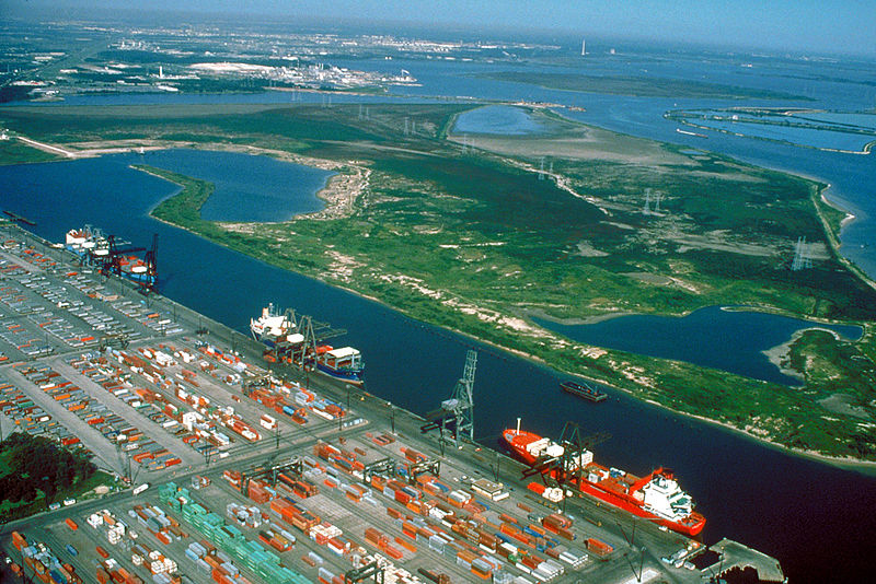
English: Aerial view of the Barbour's Cut area on the Houston Ship Channel in Houston, Texas, USA. This area is a large container terminal. This photograph appears to have been taken before the Fred Hartman Bridge was built, or when the bridge was under construction. In a present-day photograph, the bridge should be clearly visible at top right.
Coordinates: 29°40′54.98″N 94°59′54.37″W / 29.6819389°N 94.9984361°W |
|||
| Local | Houston, Texas, USA | |||
| Data | Probably pre-1995 | |||
| Origem |
U.S. Army Corps of Engineers Digital Visual Library Image page Image description page Digital Visual Library home page |
|||
| Autor | U.S. Army Corps of Engineers, photographer not specified or unknown | |||
| Permissão (Reutilizar este ficheiro) |
|
Histórico do ficheiro
Clique uma data e hora para ver o ficheiro tal como ele se encontrava nessa altura.
| Data e hora | Miniatura | Dimensões | Utilizador | Comentário | |
|---|---|---|---|---|---|
| atual | 01h22min de 10 de maio de 2007 | | 1 500 × 1 001 (693 kB) | DanMS | {{Information | Description = {{en|Aerial view of the Barbour's Cut area on the Houston Ship Channel in Houston, Texas, USA. This area is a large container terminal. This photograph appears to have been taken before the Fred Hartman Bridge was built, o |
Utilização local do ficheiro
As seguintes 2 páginas usam este ficheiro:
Utilização global do ficheiro
As seguintes wikis usam este ficheiro:
- ar.wikipedia.org
- bn.wikipedia.org
- de.wikipedia.org
- en.wikipedia.org
- es.wikipedia.org
- eu.wikipedia.org
- fi.wikipedia.org
- fr.wikipedia.org
- gu.wikipedia.org
- hu.wikipedia.org
- it.wikipedia.org
- ja.wikipedia.org
- lt.wikipedia.org
- ml.wikipedia.org
- nl.wikipedia.org
- no.wikipedia.org
- pl.wikipedia.org
- pnb.wikipedia.org
- ru.wikipedia.org
- te.wikipedia.org
- tr.wikipedia.org
- uk.wikipedia.org
- ur.wikipedia.org
- uz.wikipedia.org
- vi.wikipedia.org
- www.wikidata.org
Ver mais utilizações globais deste ficheiro.