Ficheiro:Intracoastal Waterway at Bayou Barataria.jpg
Dimensões desta antevisão: 800 × 533 píxeis. Outras resoluções: 320 × 213 píxeis | 640 × 427 píxeis | 1 024 × 683 píxeis | 1 500 × 1 000 píxeis.
Imagem numa resolução maior (1 500 × 1 000 píxeis, tamanho: 396 kB, tipo MIME: image/jpeg)
|
|
Esta imagem provém do Wikimedia Commons, um acervo de conteúdo livre da Wikimedia Foundation que pode ser utilizado por outros projetos.
|
| Descrição |
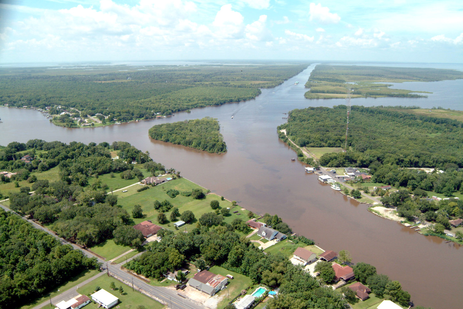
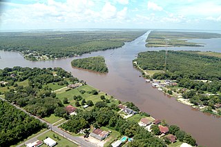
English: Aerial view of a northern section of Jean Lafitte, Louisiana at the Gulf Intracoastal Waterway (GIWW). The waterway stretches off to the southwest at the top of the picture and also turns right into the Bayou Villars and Lake Salvador at the right. Bayou Barataria runs off to the left. |
|||
| Data | ||||
| Origem |
U.S. Army Corps of Engineers Digital Visual Library Image page Image description page Digital Visual Library home page |
|||
| Autor | Lane Lefort, U.S. Army Corps of Engineers | |||
| Permissão (Reutilizar este ficheiro) |
|
|||
| Local | Jefferson Parish, Louisiana |
| Localização da câmara | | Esta e outras imagens nas suas localizações em: OpenStreetMap |
|---|
Histórico do ficheiro
Clique uma data e hora para ver o ficheiro tal como ele se encontrava nessa altura.
| Data e hora | Miniatura | Dimensões | Utilizador | Comentário | |
|---|---|---|---|---|---|
| atual | 23h23min de 7 de abril de 2007 | | 1 500 × 1 000 (396 kB) | DanMS | {{Information | Description = {{en|Aerial view of a northern section of Jean Lafitte, Louisiana at the Gulf Intracoastal Waterway (GIWW). The waterway stretches off to the southwest at the top of the picture and also turns right into the Bayou Villars |
Utilização local do ficheiro
A seguinte página usa este ficheiro:
Utilização global do ficheiro
As seguintes wikis usam este ficheiro:
- ar.wikipedia.org
- arz.wikipedia.org
- azb.wikipedia.org
- ca.wikipedia.org
- ceb.wikipedia.org
- ce.wikipedia.org
- cy.wikipedia.org
- en.wikipedia.org
- en.wikivoyage.org
- es.wikipedia.org
- eu.wikipedia.org
- fa.wikipedia.org
- fr.wikipedia.org
- ht.wikipedia.org
- it.wikipedia.org
- lld.wikipedia.org
- nl.wikipedia.org
- pl.wikipedia.org
- sh.wikipedia.org
- sr.wikipedia.org
- tt.wikipedia.org
- uk.wikipedia.org
- www.wikidata.org
- zh-min-nan.wikipedia.org