Ficheiro:Kanawha Ohio confluence.jpg

Dimensões desta antevisão: 751 × 600 píxeis. Outras resoluções: 301 × 240 píxeis | 601 × 480 píxeis | 962 × 768 píxeis | 1 280 × 1 022 píxeis | 1 500 × 1 198 píxeis.
Imagem numa resolução maior (1 500 × 1 198 píxeis, tamanho: 724 kB, tipo MIME: image/jpeg)
|
|
Esta imagem provém do Wikimedia Commons, um acervo de conteúdo livre da Wikimedia Foundation que pode ser utilizado por outros projetos.
|
Descrição do ficheiro
| Descrição |
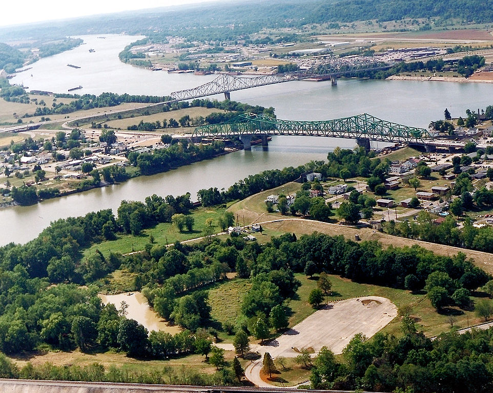
English: The confluence of the Kanawha and Ohio Rivers. The Kanawha River flows in from the left of the picture and joins the Ohio, meandering off in the distance. The town of Point Pleasant, West Virginia is in the foreground on the right. Henderson, West Virginia is on the left. The Ohio River forms the boundary between West Virginia and Ohio. The town of Gallipolis, Ohio lies in the far distance across the Ohio River. The view is to the west-southwest down the river. |
|||
| Data | antes de 2007 | |||
| Origem |
U.S. Army Corps of Engineers Digital Visual Library Image page Image description page Digital Visual Library home page |
|||
| Autor | Charles Johnson, U.S. Army Corps of Engineers | |||
| Permissão (Reutilizar este ficheiro) |
|
|||
| Local | Point Pleasant, West Virginia, USA |
| Localização da câmara | | Esta e outras imagens nas suas localizações em: OpenStreetMap |
|---|
| Anotações | Esta imagem está anotada: Ver as anotações na wiki Commons |
Histórico do ficheiro
Clique uma data e hora para ver o ficheiro tal como ele se encontrava nessa altura.
| Data e hora | Miniatura | Dimensões | Utilizador | Comentário | |
|---|---|---|---|---|---|
| atual | 04h52min de 23 de março de 2007 | | 1 500 × 1 198 (724 kB) | DanMS | {{Information | Description = {{en|The confluence of the Kanawha and Ohio Rivers. The Kanawha River flows in from the left of the picture and joins the Ohio, meandering off in the distance. The town of Point Pleasant, West Virginia is in the foreground |
Utilização local do ficheiro
As seguintes 2 páginas usam este ficheiro:
Utilização global do ficheiro
As seguintes wikis usam este ficheiro:
- ar.wikipedia.org
- arz.wikipedia.org
- ca.wikipedia.org
- ceb.wikipedia.org
- ce.wikipedia.org
- cy.wikipedia.org
- dag.wikipedia.org
- de.wikipedia.org
- en.wikipedia.org
- en.wikivoyage.org
- es.wikipedia.org
- eu.wikipedia.org
- fa.wikipedia.org
- fr.wikipedia.org
- hu.wikipedia.org
- it.wikipedia.org
- ja.wikipedia.org
- ko.wikipedia.org
- kw.wikipedia.org
- lld.wikipedia.org
- no.wikipedia.org
- pl.wikipedia.org
- ro.wikipedia.org
- ru.wikipedia.org
- sh.wikipedia.org
- simple.wikipedia.org
- sr.wikipedia.org
- tt.wikipedia.org
Ver mais utilizações globais deste ficheiro.