Ficheiro:Kingdom of Romania (1890).svg

Dimensões desta antevisão em PNG do ficheiro SVG: 450 × 456 píxeis Outras resoluções: 237 × 240 píxeis | 474 × 480 píxeis | 758 × 768 píxeis | 1 011 × 1 024 píxeis | 2 021 × 2 048 píxeis.
Imagem numa resolução maior (ficheiro SVG, de 450 × 456 píxeis, tamanho: 422 kB)
|
|
Esta imagem provém do Wikimedia Commons, um acervo de conteúdo livre da Wikimedia Foundation que pode ser utilizado por outros projetos.
|


.svg)
.svg)
.svg)
.svg)
.svg)


.svg)
.svg)
.svg)


.png)
.png)


.svg)


.svg)

.svg)


.svg)
.svg)
.svg)
.svg)


.svg)
.png)


.svg)


.svg)
.svg)


.svg)


.svg)


.svg)
.svg)
.svg)
.svg)
.svg)
.svg)
.svg)
.svg)
_cropped.svg)
.svg)
.svg)
.svg)
.svg)
.svg)
.svg)
.svg)
.svg)
.svg)
.svg)
.svg)
.svg)
.svg)
.svg)
.svg)
.svg)
.svg)
.svg)
.svg)
.svg)
.svg)
.svg)
.svg)
.svg)
.svg)
.svg)
.svg)
.svg)
.svg)
.svg)
.svg)
.svg)
.svg)
.svg)
.svg)
.svg)
.svg)
.svg)
.svg)
.svg)
.svg)
.svg)
.svg)
.svg)
Histórico do ficheiro
Clique uma data e hora para ver o ficheiro tal como ele se encontrava nessa altura.
| Data e hora | Miniatura | Dimensões | Utilizador | Comentário | |
|---|---|---|---|---|---|
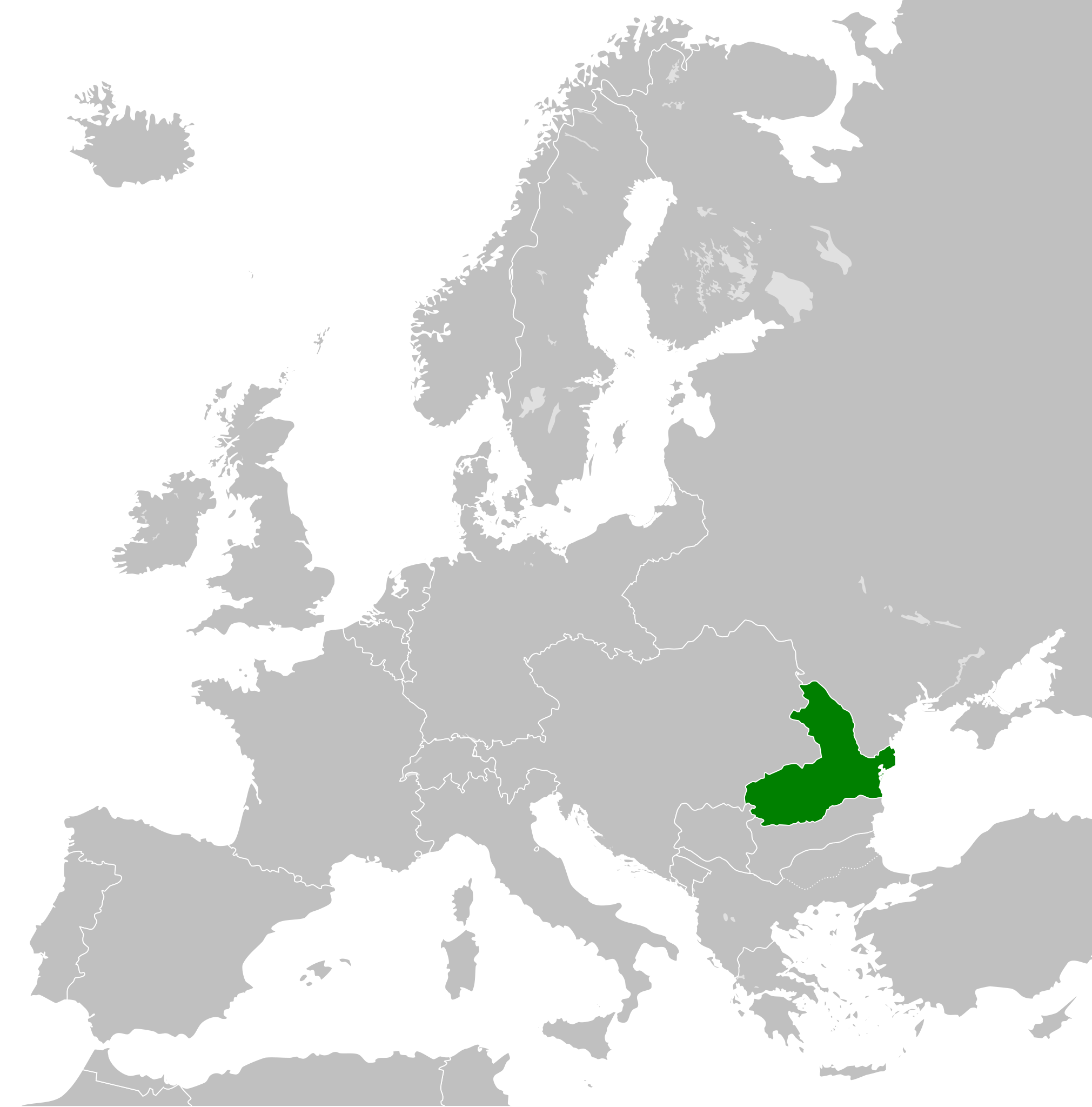
| atual | 11h32min de 25 de julho de 2012 | | 450 × 456 (422 kB) | TRAJAN 117 | {{Information |Description ={{en|1=The Kingdom of Romania in 1890.}} |Source ={{own}} {{AttribSVG|Blank map of Europe 1890.svg|Alphathon}} |Author =TRAJAN 117 {{created with Inkscape}} |Date =2012-07-25 ... |
Utilização local do ficheiro
A seguinte página usa este ficheiro:
Utilização global do ficheiro
As seguintes wikis usam este ficheiro:
- ar.wikipedia.org
- azb.wikipedia.org
- el.wikipedia.org
- en.wikipedia.org
- et.wikipedia.org
- fi.wikipedia.org
- he.wikipedia.org
- ja.wikipedia.org
- ro.wikipedia.org
- sr.wikipedia.org
- th.wikipedia.org
- zh.wikipedia.org
.svg)