Ficheiro:LaIlustracionArgentina.jpg

Imagem numa resolução maior (4 635 × 3 576 píxeis, tamanho: 2,29 MB, tipo MIME: image/jpeg)
|
|
Esta imagem provém do Wikimedia Commons, um acervo de conteúdo livre da Wikimedia Foundation que pode ser utilizado por outros projetos.
|
Descrição do ficheiro
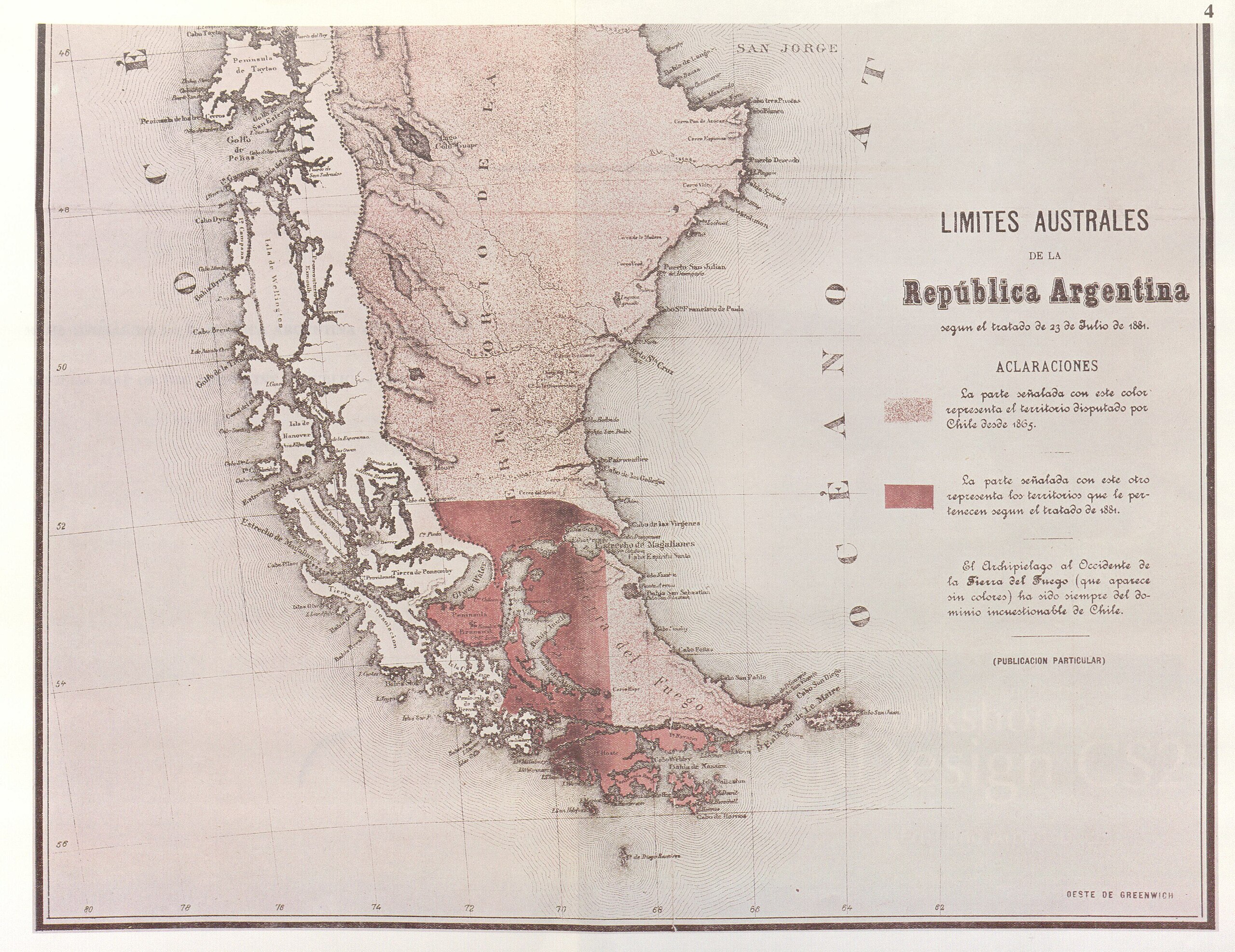
| Descrição | Parcial reproduction of the first argentinian map showing the boundaries laid down in the Boundary Treaty of 23 July 1881, appeared in "La Ilustracion Argentina" issue of 10 November 1881 in Buenos Aires. The copy reproduced here is one handed to the British Minister Plenipontentiary in Buenos Aires by Dr. Bernardo de Irigoyen, Argentine Minister of Forein Affairs who negotiated and signed the Boundary Treaty. The original is located in the official British Archives. The British Minister sent it to his Government with the comment that the dark shaded area "comprising the Strait of Magellan, half of Tierra del Fuego and all the southern islands, represent was actually has been ceded to Chile by the recent Treaty." | ||||
| Data | |||||
| Origem | Relaciones Chileno-Argentinas, La controversia del Beagle, edited by chilean Foreign Affairs, Geneve, Switzerland, 1979 | ||||
| Autor | from magazin "La Ilustracion argentina" | ||||
| Permissão (Reutilizar este ficheiro) |
|
||||
Histórico do ficheiro
Clique uma data e hora para ver o ficheiro tal como ele se encontrava nessa altura.
| Data e hora | Miniatura | Dimensões | Utilizador | Comentário | |
|---|---|---|---|---|---|
| atual | 19h32min de 3 de novembro de 2007 | | 4 635 × 3 576 (2,29 MB) | Keysanger | {{Information |Description=Parcial reproduction of the first argentinian map showing the boundaries laid down in the Boundary Treaty of 23 July 1881, appeared in "La Ilustracion Argentina" issue of 10 November 1881 in Buenos Aires. The copy reproduced her |
| 20h13min de 18 de junho de 2007 |  | 1 836 × 1 371 (545 kB) | Keysanger | {{Information |Description=Parcial reproduction of the first argentinian map showing the boundaries laid down in the Boundary Treaty of 23 July 1881, appeared in "La Ilustracion Argentina" issue of 10 November 1881 in Buenos Aires. The copy reproduced her |
Utilização local do ficheiro
A seguinte página usa este ficheiro:
Utilização global do ficheiro
As seguintes wikis usam este ficheiro:
- de.wikipedia.org
- en.wikipedia.org
- es.wikipedia.org
- fr.wikipedia.org
- he.wikipedia.org