Ficheiro:Northridge near Dayton aerial.jpg

Dimensões desta antevisão: 800 × 600 píxeis. Outras resoluções: 320 × 240 píxeis | 640 × 480 píxeis | 1 024 × 768 píxeis | 1 280 × 960 píxeis | 2 272 × 1 704 píxeis.
Imagem numa resolução maior (2 272 × 1 704 píxeis, tamanho: 2,08 MB, tipo MIME: image/jpeg)
|
|
Esta imagem provém do Wikimedia Commons, um acervo de conteúdo livre da Wikimedia Foundation que pode ser utilizado por outros projetos.
|
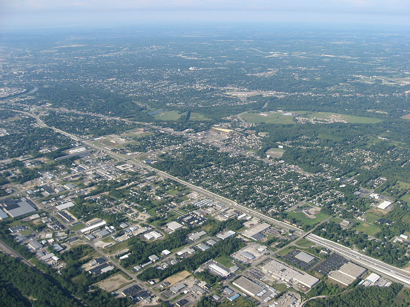
| Descrição | Aerial view of Northridge, a community on the northeast side of the city of Dayton in Montgomery County, Ohio, United States. Interstate 75 is clearly visible in the middle of the picture, with the major intersection toward the left side of the picture being the highway's interchange with Needmore Road. The Great Miami River is visible on the far left edge of the picture. Picture taken from a Diamond Eclipse light airplane at an altitude of 4,480 feet MSL and a bearing of approximately 220º. | ||
| Data | Tirada em 12 de agosto de 2008 | ||
| Origem | Obra do próprio | ||
| Autor | Nyttend | ||
| Permissão (Reutilizar este ficheiro) |
|
Histórico do ficheiro
Clique uma data e hora para ver o ficheiro tal como ele se encontrava nessa altura.
| Data e hora | Miniatura | Dimensões | Utilizador | Comentário | |
|---|---|---|---|---|---|
| atual | 00h58min de 19 de setembro de 2008 | | 2 272 × 1 704 (2,08 MB) | Nyttend | {{Information |Description=Aerial view of {{w|Northridge, Montgomery County, Ohio|Northridge}}, a community on the northeast side of the city of {{w|Dayton, Ohio|Dayton}} in {{w|Montgomery County, Ohio|Montgomery County}}, {{w|Ohio}}, {{w|United States}}. |
Utilização local do ficheiro
A seguinte página usa este ficheiro:
Utilização global do ficheiro
As seguintes wikis usam este ficheiro:
- azb.wikipedia.org
- ca.wikipedia.org
- ceb.wikipedia.org
- en.wikipedia.org
- es.wikipedia.org
- eu.wikipedia.org
- fa.wikipedia.org
- it.wikipedia.org
- sr.wikipedia.org
- ur.wikipedia.org
- vi.wikipedia.org
- www.wikidata.org
- zh-min-nan.wikipedia.org
- zh.wikipedia.org