Ficheiro:OttomanEmpire1801.jpg
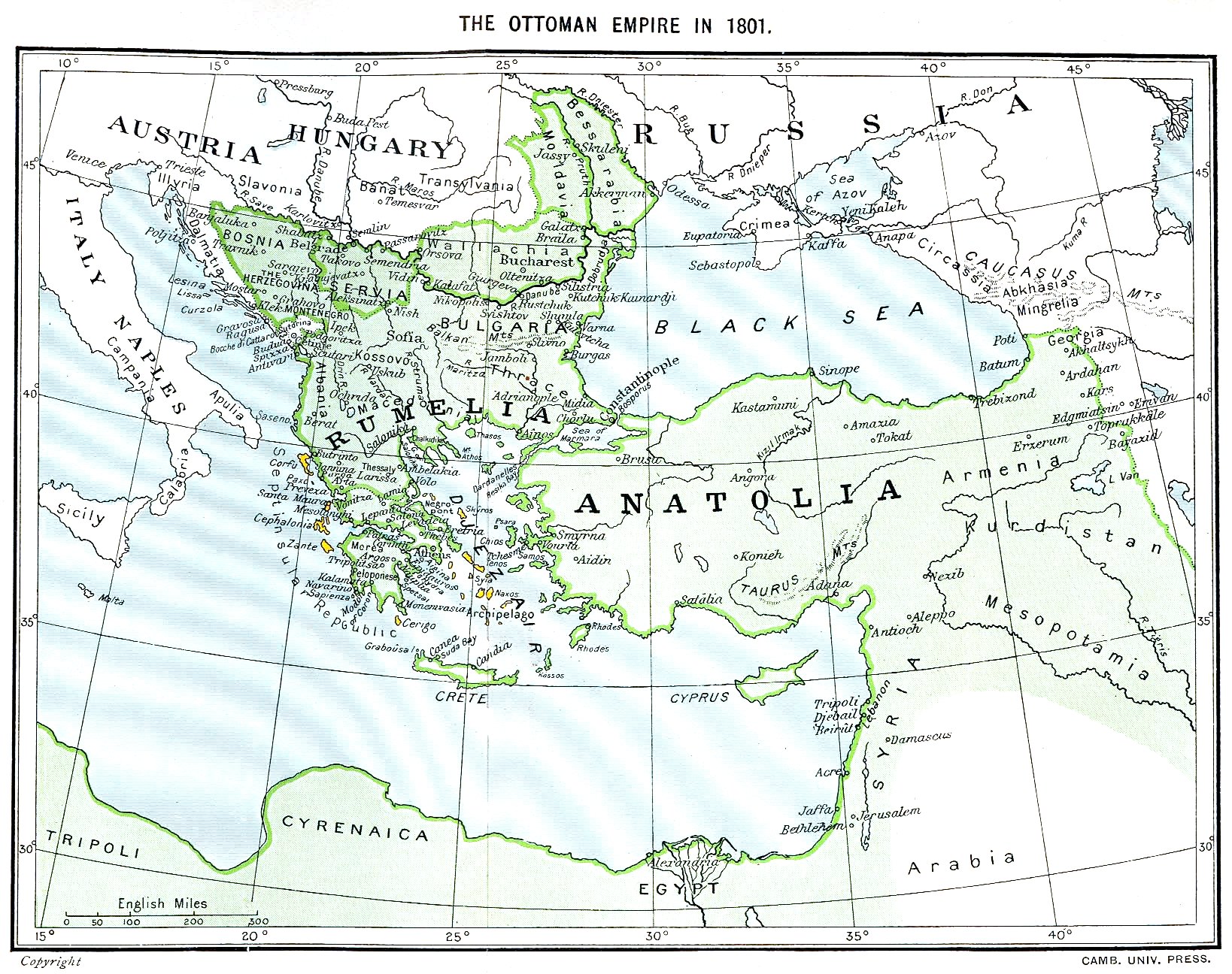
Imagem numa resolução maior (1 638 × 1 296 píxeis, tamanho: 605 kB, tipo MIME: image/jpeg)
|
|
Esta imagem provém do Wikimedia Commons, um acervo de conteúdo livre da Wikimedia Foundation que pode ser utilizado por outros projetos.
|

Descrição do ficheiro
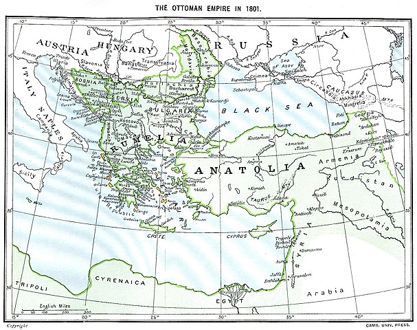
Ottoman Empire (green) and Septinsular Republic (yellow) in 1801.
Licenciamento
|
Esta obra está no domínio público no seu país de origem e noutros países e áreas onde o período de proteção dos direitos de autor é igual ou inferior à vida do autor mais 70 anos.
| |
| Este ficheiro foi considerado livre de restrições conhecidas devidas a direitos de autor, incluindo todos os direitos conexos. | |
Histórico do ficheiro
Clique uma data e hora para ver o ficheiro tal como ele se encontrava nessa altura.
| Data e hora | Miniatura | Dimensões | Utilizador | Comentário | |
|---|---|---|---|---|---|
| atual | 16h06min de 11 de janeiro de 2023 | | 1 638 × 1 296 (605 kB) | Enyavar | Reverted to version as of 08:56, 11 March 2006 (UTC) --> even if they are wrong, don't change historical maps! |
| 17h48min de 3 de fevereiro de 2014 |  | 1 638 × 1 296 (518 kB) | Spiridon Ion Cepleanu | Some little changes according with the 1801 situation : The Septinsular Rep. includes Ionian Is., not the Cyclades, Serbia became autonomous 1817... | |
| 08h56min de 11 de março de 2006 |  | 1 638 × 1 296 (605 kB) | Julo | Ottoman Empire (green) & Septinsular Republic (yellow) in 1801, on the 19th century map {{PD-old}} category:19th century mapsCategory:Historical maps of the Middle EastCategory:Historical maps of the Balkans[[Category:Historical maps of Africa |
Utilização local do ficheiro
Não há nenhuma página que use este ficheiro.
Utilização global do ficheiro
As seguintes wikis usam este ficheiro:
- azb.wikipedia.org
- ba.wikipedia.org
- el.wikipedia.org
- fr.wikipedia.org
- hy.wikipedia.org
- la.wikipedia.org
- pl.wikipedia.org
- sq.wikipedia.org
- sv.wikipedia.org
- uk.wikipedia.org