Ficheiro:USACE Perdido Bay.jpg
Dimensões desta antevisão: 800 × 575 píxeis. Outras resoluções: 320 × 230 píxeis | 640 × 460 píxeis | 1 024 × 737 píxeis | 1 280 × 921 píxeis | 1 500 × 1 079 píxeis.
Imagem numa resolução maior (1 500 × 1 079 píxeis, tamanho: 438 kB, tipo MIME: image/jpeg)
|
|
Esta imagem provém do Wikimedia Commons, um acervo de conteúdo livre da Wikimedia Foundation que pode ser utilizado por outros projetos.
|
| Descrição |
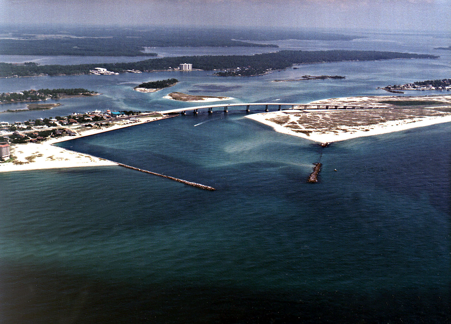
English: Perdido Pass, the mouth of the Perdido River and Perdido Bay on the Gulf of Mexico at Orange Beach, Alabama, USA. Alabama State Route 182 crosses the inlet. The image description on the USACE source page has misidentified the highway on the bridge as U.S. Route 98. |
|||
| Local | Orange Beach, Alabama, USA 30°16′40.96″N 87°33′18.72″W / 30.2780444°N 87.5552°W |
|||
| Data | not specified | |||
| Origem |
U.S. Army Corp of Engineers Digital Visual Library Digital Visual Library home page Image page Image description page |
|||
| Autor | Adrien Lamarre, U.S. Army Corps of Engineers | |||
| Permissão (Reutilizar este ficheiro) |
|
Histórico do ficheiro
Clique uma data e hora para ver o ficheiro tal como ele se encontrava nessa altura.
| Data e hora | Miniatura | Dimensões | Utilizador | Comentário | |
|---|---|---|---|---|---|
| atual | 04h35min de 14 de março de 2007 | | 1 500 × 1 079 (438 kB) | DanMS | {{Information | Description = Perdido Pass, the mouth of the Perdido River and Perdido Bay on the Gulf of Mexico at Orange Beach, Alabama, USA. Alabama State Route 182 crosses the inlet. The image description on the USACE source page has misidentified the |
Utilização local do ficheiro
Não há nenhuma página que use este ficheiro.
Utilização global do ficheiro
As seguintes wikis usam este ficheiro:
- ar.wikipedia.org
- ceb.wikipedia.org
- de.wikipedia.org
- en.wikipedia.org
- es.wikipedia.org
- fr.wikipedia.org
- ru.wikipedia.org
- www.wikidata.org